

Flood Hazard and Risk Maps in Bosnia and Herzegovina – Annex for the Trebisnjica River Basin District in the Republika Srpska
The Project Consortium of Bijeljina’s Institute for Water Management (IWM) and the Institute for Hydraulic and Environmental Engineering of the Faculty of Civil Engineering in Belgrade were tasked to develop flood hazard and flood risk maps for the Trebisnjica River Basin District (RBD) in the Republika Srpska (ES). This is part of the WB12-BIH-ENV-04 Project Flood Hazard and Flood Risk Maps Project in Bosnia and Herzegovina, which is presented under the Western Balkans Investment Framework in support of a joint initiative of the EU, international financial institutions, bilateral donors and the governments of the Western Balkans.
Based on detailed analyses, this project presented the characteristics of flood areas according to international criteria and addressed the issue of sustainable management of flood hazards and risks by prioritizing them on a number of criteria. The aim was to raise awareness of the population and institutions at all levels, as well as to initiate new mechanisms for managing flood hazards and risks.
Given the specific hydrological and hydraulic features of the karst area of eastern Herzegovina and the extent of gauging data, this project for the Trebisnjica RBD in the RS follows separate Terms of Reference.
In accordance with the ToR and the time schedule, the components of the flood hazard and risk maps for the Trebisnjica RBD in the RS were completed in a period of 10 months. They were presented in detail in separate Reports (as listed below) and summarized in the Final Report:
- Inception Report;
- Report on Geodetic Maps and Data;
- Report on Hydrogeological, Morphological and Erosion Characteristics of the Trebisnjica RBD;
- Hydrological Report;
- Hydraulic Report;
- Report on Input Data for Flood Risk Maps;
- Report on Flood Hazard Maps;
- Report on Flood Risk Maps; and
- Final Report.
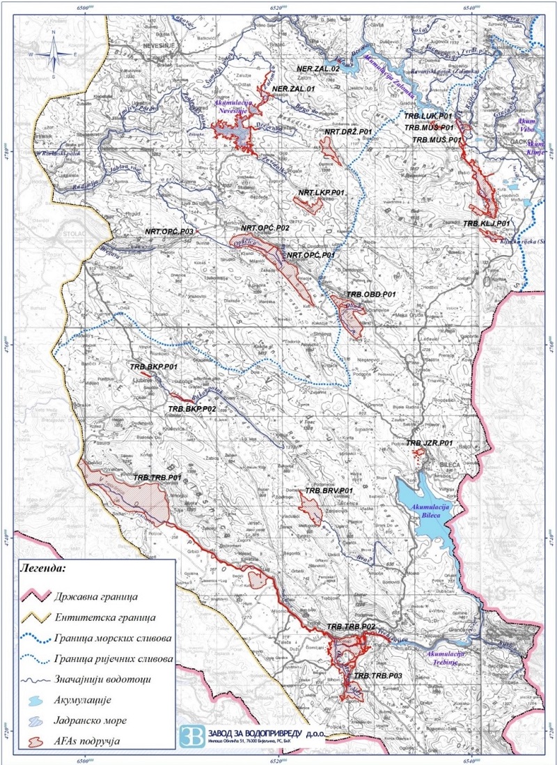
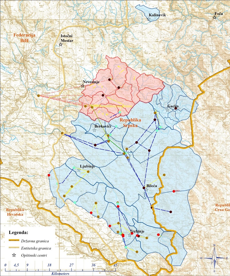
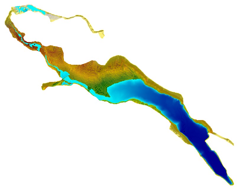
Twenty areas were proposed for further assessment (AFAs) in the Trebisnjica RBD in the RS, of which 12 are in the Trebisnjica basin and 8 in the Neretva basin (Figure 1). Appropriate hydrological and hydraulic analyses and calculations were carried out in these areas, taking into account other data. The final output were flood hazard and flood risk maps.
The methodology for the development of flood hazard and flood risk maps in this Project provided realistic review and assessment of flood risks in all areas defined by the PFRA as significant or extremely significant, regardless of the category of watercourses, but primarily taking into account that the areas are predominantly karst regions with all their hydrological and hydraulic characteristics.
Geodetic Survey Data
The spatial extent of the LiDAR survey was defined on the basis of identified AFAs during the preparation of a preliminary flood risk assessment in the Trebisnjica RBD. For the purpose of forming the DTM, the historic flood outlines were expanded so as to include the areas with computed flood flows of smaller probability. The river channels were geodetically surveyed to the top of the main channel banks, including the river valley areas covered by LiDAR. The surveyed cross-sections of the main river channels were used to form a hybrid DTM, which integrates the terrain model obtained by the LiDAR surveys of river valleys and the channel model formed from geodetic cross-section surveying.
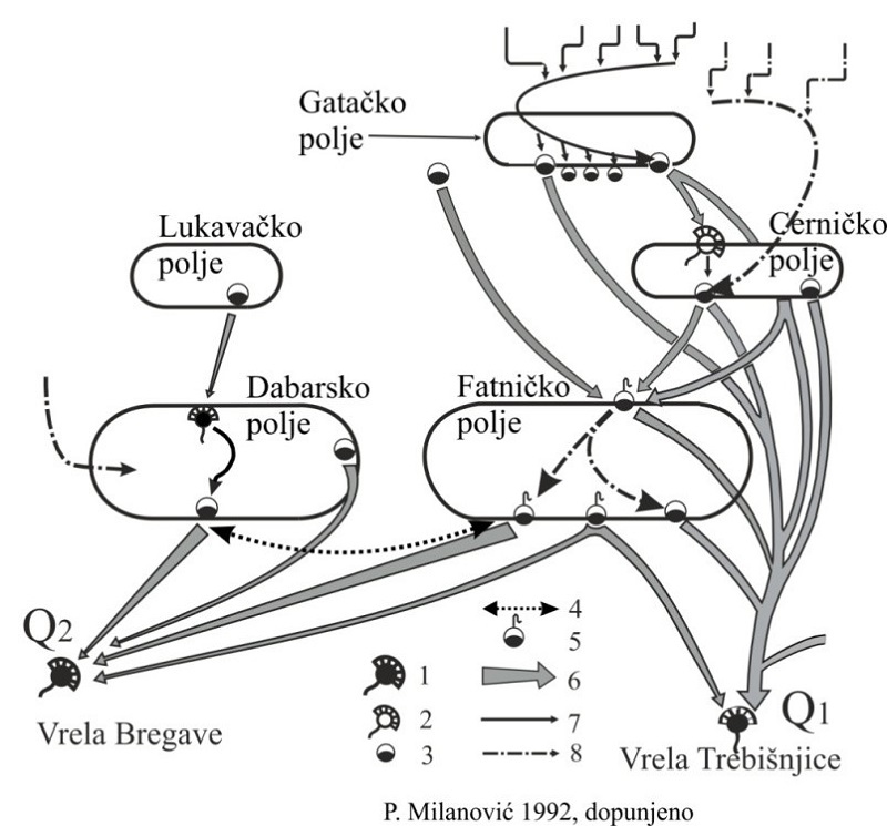
Hydrogeological, Morphological and Erosion Characteristics of the Trebisnjica RBD
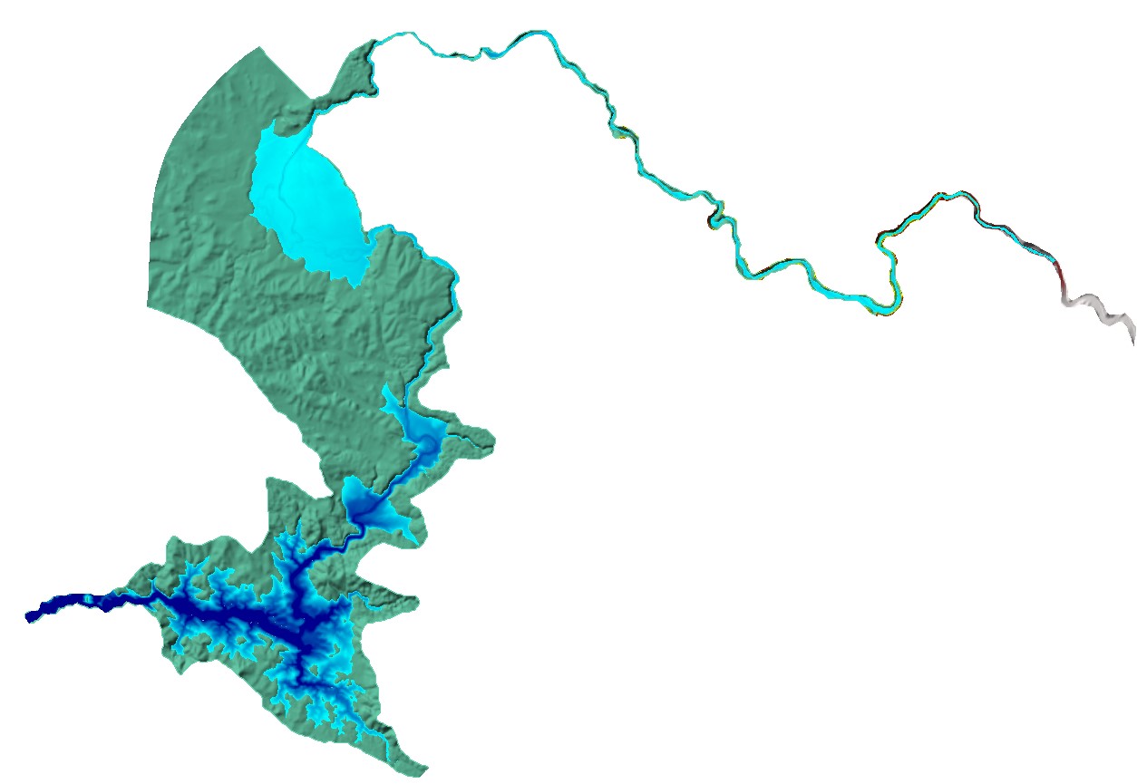
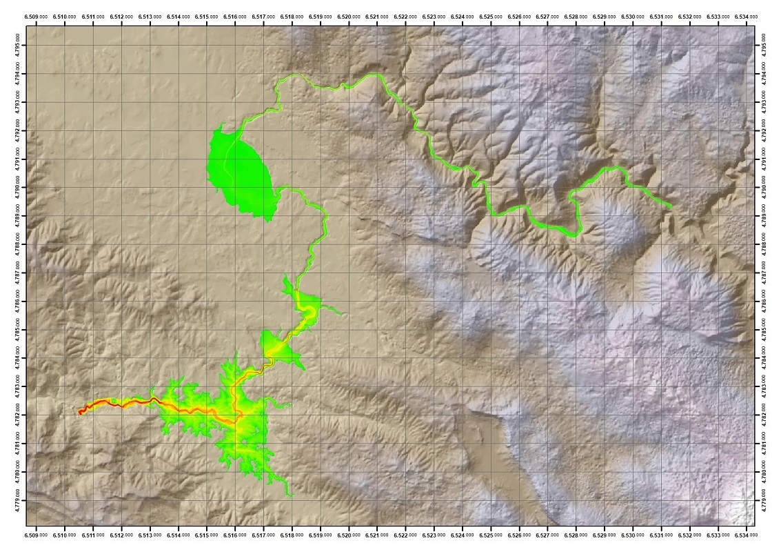
The key contribution to the development of these maps and data was to define the flow paths through underground connections, swallow capacities at key sites, as well as to define drainage areas in karst conditions. These maps and data were crucial for appropriate formation of mathematical hydrological and hydraulic models. These data also provide erosion characteristics (erosion map). A detailed analysis of river channels was carried out and morphological characteristics were defined, which was necessary for developing hydraulic models (Figure 2).
Hydrological Data
The following hydrological data were available:
- Traditional rain gauging stations: 52 stations
- Automatic weather stations: 8 stations
- Traditional river gauging stations: 7 stations
- Automatic river gauging stations: 19 stations
- Automatic measurements of groundwater level: 13 piezometers
- Automatic measurements of flow rate in tunnels (Dabar-Fatnica (DF) tunnel and Fatnica – Bileca Lake (FBL) tunnel)
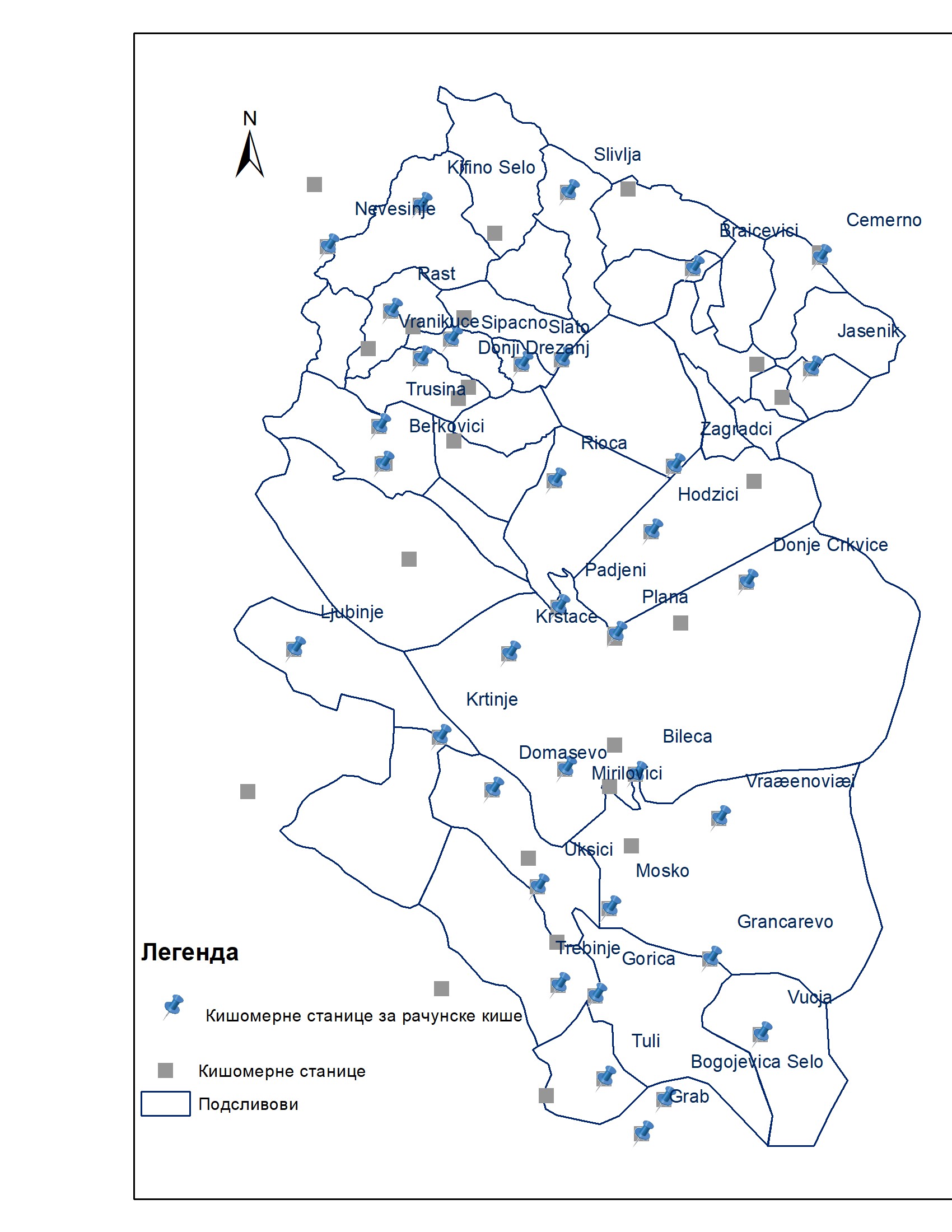
Design rain depths at the Trebisnjica basin are estimated from observations from thirty-five gauges, which are selected considering the length of record periods, maximum observed daily rainfall, and spatial coverage of the sub-catchments. Given that long record periods are needed for reliable statistical analyses, the gauges with at least fifteen years of observations were selected (Figure 3).
For simulation of design floods (hydrographs) of 20-, 100- and 500-year return periods, the 3DNet-Catch hydrologic model was forced with the design rainfall of the corresponding return periods (Figure 4).
The Hydrology Report set out the required design flood discharges Q(t) of T20, T100 and T500 return periods, and the design flood levels H(t) in karst poljes for these return periods. The results were presented for the characteristic river profiles that were included in the hydraulic modelling for the designated AFAs of the Trebisnjica RBD in the RS.The analysis of the design rainfall was the starting point for carrying out this complex hydrological task. The coefficients of the calibration produced an appropriate basis to provide the required results. Additional activities were carried out to analyse and define indicators of downstream impacts / flood levels in Popovo polje on the inter-entity boundary line. The project activities included the collection and definition of basic drainage parameters in the area of Popovo polje in the Federation of B&H. In this way, all boundary conditions for the hydraulic model of the river Trebisnjica in the RS were defined.Building a physically based distributed hydrological model was desirable and necessary for two key reasons: • the geographical features and conditions of the catchment area, which is karst dominated by subsurface flows and links between the karst poljes; and • evident limitations related to data and maps (out-of-date rating curves from GSs, a modest base of long-term hydrological series and data in karst poljes). The results of this model are a significant contribution to the project in terms of understanding of the occurrence and origin of floods in karst poljes.A computed balance algorithm was developed within the hydrological analysis which was not specified in the ToR but was necessary for consideration of the flood retention impact of the reservoirs on the downstream flow regime of the Trebisnjica.Complex and extensive work was carried out in an extremely short period, providing realistic bases for the formation of hydraulic models. The results (design flood hydrographs) were verified after the implementation of the hydraulic models. The need for any revision of the flood hydrographs was considered during the calibration of the hydraulic models.The analyses and the results obtained in the Hydrology Report for the Trebisnjica River were made available to the downstream area of Popovo polje in the Federation of B&H, taking into account the methodology and differences in design flood flows.
Hydraulic Modelling and Analyses
We developed hydraulic models that:
- Simulate complex flood wave conditions in karst (physically based semi-distributed 3Dnet precipitation-surface and subsurface runoff model);
- Define the flood wave attenuation in reservoirs, according to verified and approved reservoir management plans, and
- Provide hydraulic modelling and calculation of hydraulic parameters in open channels (a total of 7 mathematical models) as well as descriptions of applied 1D and 2D models in certain floodplains.
The 3DNet model was calibrated during the formation of the hydrological model. The results of this model were used as boundary conditions (levels) of flooding in karst poljes, to which a mathematical model of open channels was added.The 3DNet-HET precipitation-surface and subsurface runoff model looked at the cause of flooding in the following areas:
- Popovo and Morko poljes in Trebinje,
- Ljubomirsko polje,
- Bilecko polje,
- Fatnicko polje,
- Flooding in the area around the Ponikva ponor in Dabarsko polje,
- Malo Gatacko polje,
- Flood zone of the Zalomka River in the area around the Biograd ponor,
- Flood zone of Lukavicko polje,
- Flood zone of Slato polje,
The results of precipitation-surface and subsurface runoff modelling in the above-mentioned areas are design levels of modelled flood probabilities with identified flood duration. A classic 1D and 2D hydraulic modelling of flow in open channels was carried out for the following rivers:
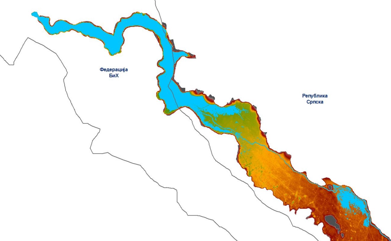
- The Trebisnjica downstream from the Gorica dam to Popovo polje;
- The Bukov Stream;
- The Londza and Brova Rivers;
- The Opacica River including the Vrijeka;
- The Zalomka River including the Zovidolka;
- The Musnica River including the Gracanica and the Gojkovic Stream; and
- The Tatinac Stream.
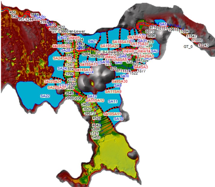
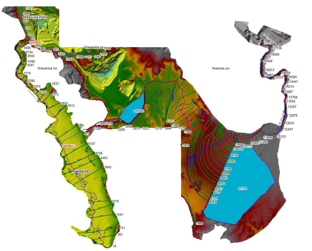
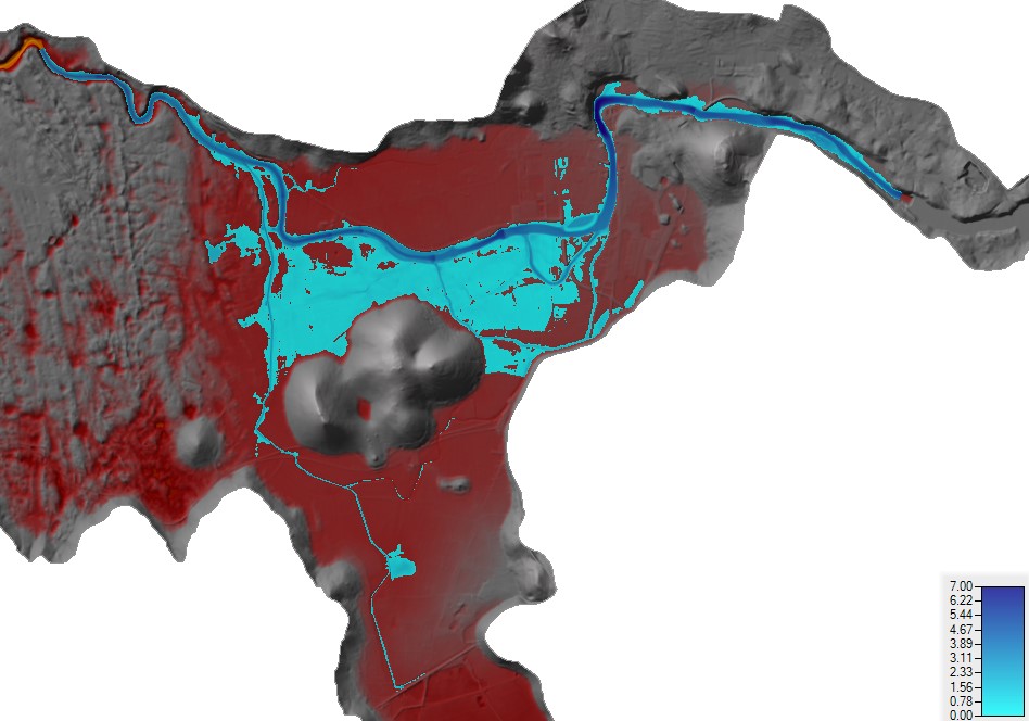
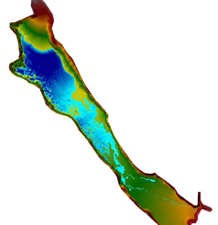
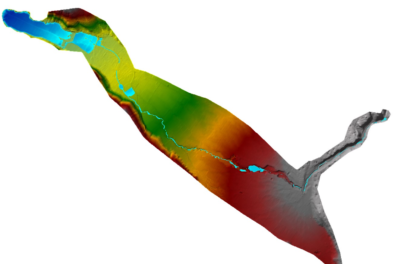
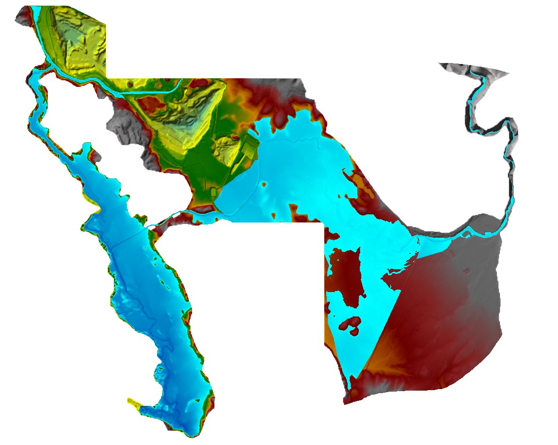
Considerable attention was paid to the calibration and analysis of key boundary conditions for the river Trebisnjica downstream of the Trebinje II HPS and the occurrence of flood waves for the design return periods (20, 100 and 500 years). This took into account the impact of the reservoirs in terms of flood flow attenuation and the dominant impact of the water from the drainage basin downstream of the Trebinje I HPS which cannot be attenuated in reservoirs. The result of mathematical models of open channels is an extent of flooding and water depth for all floodplains, sections of water courses and in karst poljes. Also, analyses and results from mathematical models that define the flooding of karst poljes were provided. The calculation and the results of modelled flood levels on the basis of statistical hydrological analyses are given for Cernicko polje, as well as the results of the modelled flood levels using the physically based semi-distributed 3Dnet model, including the floodplain of Popovo polje at the inter-entity boundary line The output of hydraulic modelling are 13 models of steady flow and one model for unsteady flow. 2D mathematical hydraulic models were developed for the areas under flood risk by the rivers Trebisnjica and Musnica in Gatacko polje (Figures 7 – 13).
Flood Hazard Maps
Flood hazard maps for the Trebisnjica RBD in the RS were developed for the flood flows of 20, 100 and 500- year return periods. Flood hazard is presented with basic data on hazard values for the specified area and return period (Figure 14).
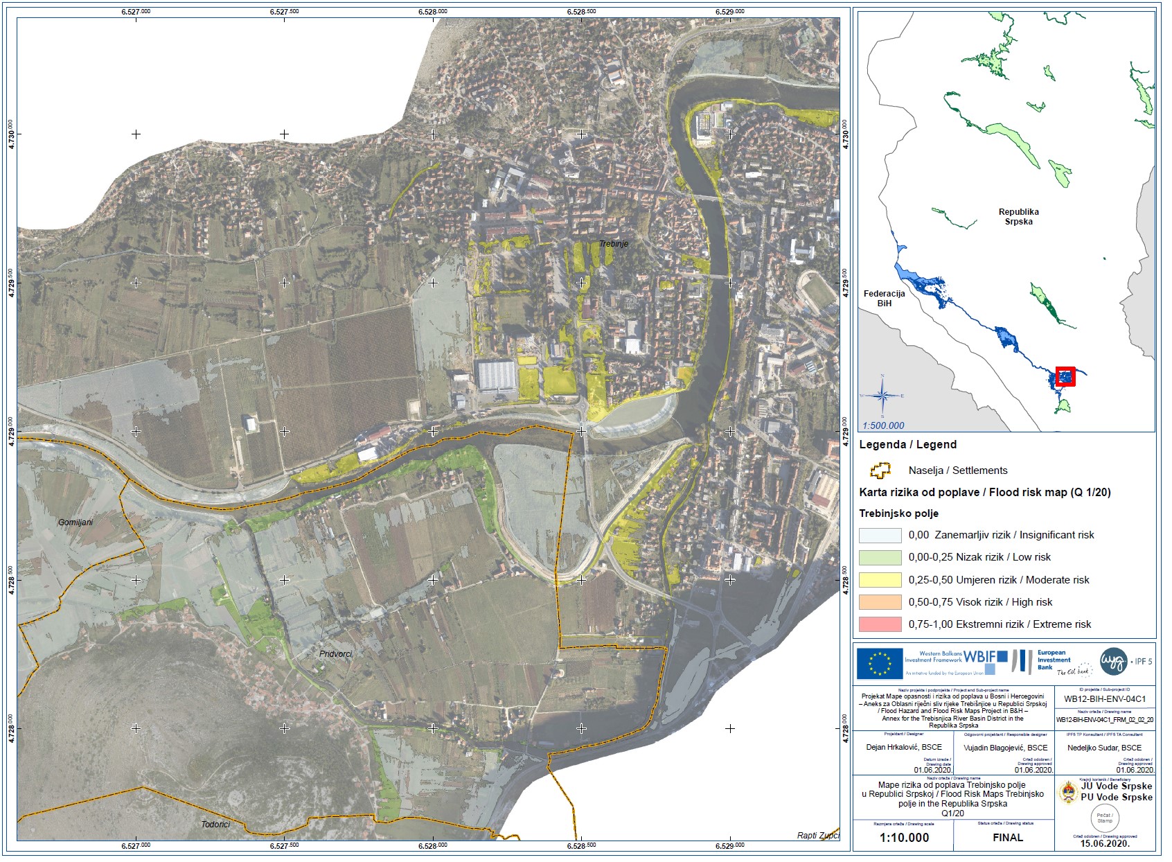
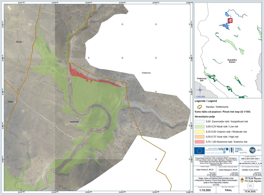
Flood Risk Maps
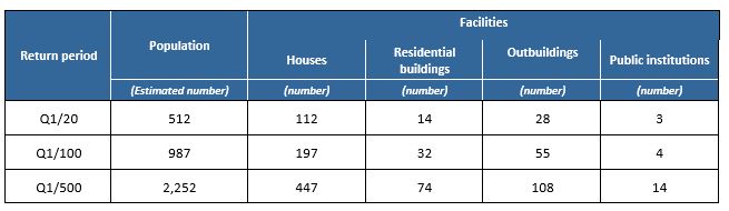
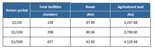
Flood risks in the Trebisnjica RBD were calculated using the data obtained for flood events of 20, 100 and 500-year return periods. We collected all available data on population and goods at risk of flooding for 20, 100 and 500-year return periods (Tables 1-3).
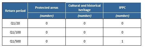
Flood risks are result of multiplied hazard rating and reference risk for the respective point. The sum of all individual values of a given risk category for a given area represents the total flood risk of that area (Figures 15-16).The Floods Directive defines the following vulnerable categories:
- Population;
- Economy;
- Protected areas;
- Cultural-historical monuments and religious buildings;
- IPPC installations.
All the above categories of flood risk were considered and defined for the Trebisnjica RBD in the RS in GIS and PDF format for wide use.