STUDY ON DISLOCATION AND EXTRACTION OF MATERIAL FROM THE RIVER BED
Ministry of Agriculture, Forestry and Water Management, Public Institution „Vode Srpske“, 2022
During 2022, Zavod za vodoprivredu has developed Studies for dislocation and extraction of material from the watercourses on 47 locations. Locations for the Studies on disposing river sediment are identified by Terms of Reference and selected by river basins based on following numbering:
- Sava - 4 locations;
- Drina - 14 locations;
- Ćehotina - 1 location;
- Lim - 1 location;
- Križevica - 1 location;
- Bosna - 6 locations;
- Velika Usora - 3 locations;
- Ukrina - 1 location;
- Vrbanja - 1 location;
- Una - 8 locations;
- Sana - 4 locations
- Mlječanica - 3 locations.
Studies were developed in accordance with: Terms of Reference, Regulation book on type of river channel and water land maintenance (Official Gazette of RS, no. 15/22) and other legislations and regulations in Republika Srpska.
Hydraulic analyses and mathematical modelling were performed for natural status and status after dislocation and extraction of materials from the river channel for the correct and detailed review of all hydrological and morphological features of watercourses on considered locations.
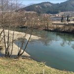
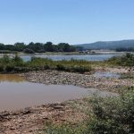
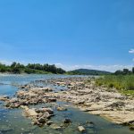
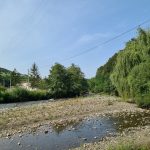
Position of sediment that should be disposed were identified for all locations. Consequences for not removing the sediment can be multiple, and mostly they manifest through the following: reduction of discharge profile of the watercourse, possibility of potential erosion and demolishing of banks, creating unfavourable hydraulic images etc.Studies were developed in three series.
First set of studies, cover 21 location for dislocation and extraction of materials from the watercourse for which technical solutions were developed, and which refer to following rivers: Sava, Drina, Čehotina, Lim and Križevica. On the Sava following locations were considered:
- Location „Brusnica Velika“, on territory of Brod municipality, c/a 5.70 km downstream from the confluence of Boundary channel with Sava. Sediment identified for dislocation is located in the minor bed at the right half of flood way half-round gutter. Section where channelizing was performed was L=615.00 m long;
- Location „Dolina“ is located in the area of the City of Gradiska, in the area of PS „Dolina“ which serves for inland waters transport. Sediment identified for removal is in the minor bed at the right half of the flow way half-round gutter. Section where channelization was performed was L=1 040.00 m long;
- Location „Uštica“, is located in the area of Kozarska Dubica area, immediately downstream of Una confluence with Sava. Sediment identified for removal is in the minor bed at the right half of the flow way half-round gutter. Section where profiling was performed was L=1 050.06 m long;
- Location „Uštica“, is located in the Kozarska Dubica municipality, immediately downstream of Una confluence with Sava. Sediment identified for removal is in the minor bed at the right half of the flow way half-round gutter. Section where profiling was performed was L=1 050.06 m long;
- Location „Kej-Luka“, is located in the area of Šamac municipality. Sediment identified for removal is in the minor bed at the right half of the flow way half-round gutter. Section of the location where profiling was performed was L=1 548.77 m long.
On Drina following locations are considered:
- Location „Ušće Drine“, is downstream in length of 950m away from the Drina confluence with Sava, in the area of KO Crna Bara, Republic of Serbia. Sediment identified for removal is in minor bed of Drina, along the left bank. Section of the location identified for channelization was L=951.85 m long;
- Location „Međaši“, is c/a 8.00 km upstream of Drina confluence with Sava. This location covers two cadastral municipalities, K.O. Crnobarski Salaš (Bogatić municipality, Republic of Serbia) and K.O. Međaši, (Bijeljina municipality). Sediment identified for removal is in minor bed along the left bank. Section where channelization was performed was 1 906.95 m long;
- Location „Drinska ruža-uzvodno“, is 2.50 km upstream of Pavlovića bridge, in the area that belongs to Badovinci, Republic of Serbia. It is necessary to remove sandbank – gravel deposition, along the left bank. Section where channelization was performed was 1 829.65 m long;
- Location „Amajlije 1“ is in the lower Drina river course, 3.50 km upstream of border crossing, i.e. Pavlovica bridge, in the area that belongs to K.O. Badovinci. Sediment which should be removed is disposed in minor bed at the left bank. Section where profiling was performed was 1 346.77 m long;
- Location „Amajlije 3“, is in the lower course of Drina, 6.0 km upstream of Pavlović bridge, within the cadastre area of Prnjavor municipality, Republic of Serbia. Sediment that should be disposed is in the minor bed along the left bank. Section where channelization was performed was L=1 647.61 m long;
- Location „Lokacija 1“ is in the Drina lower course, c/a 7.0 km upstream of confluence with Sava in the area within Crnobarski Salaš cadastre, Republic of Serbia. Position of sediment that should be removed is in minor bed of Drina along the left bank on distance of c/a 400 m upstream from newly constructed „Balatun“ revetment. Section where channelization was performed was L=999.43 m long;
- Location „Lokacija 2“ is within Drina lower course in length of c/a 12.0 km upstream of confluence with Sava, in the area belonging to cadastre municipality of Badovinci, Republic of Serbia. Sediment identified for removal is in minor bed along the left bank. Section where channelization was performed was L=1 101.76 m long;
- Location „Lokacija 3“ is in the lower course of Drina for c/a 1.0 km downstream of border crossing Bijeljina-Badovinci, i.e. Pavlović bridge. Sediment that was identified for removal was disposed at the convex bank. Section where channelization was performed was 2 619.79 m;
- Location „Lokacija 7“ is in the lower course of Drina, section c/a 25.00 km long from Pavlovica bridge, area of Loznica municipality. Section where channelization was performed was 2 199.39 m;
- Location „Lokacija 8“ is on Drina, c/a 46+278 km upstream of Drina confluence with Sava, on the area of cadastre municipality Šor, Loznica, Republic of Serbia. Sediment identified for removal is in the minor bed along the left bank. Section where canalization was performed was L=2 153.05 m long;
- Location „Lokacija 9“ is on Drina, 29.50 km upstream of Pavlovića bridge, in the area of Bijeljina in Republika Srpska, K.O. Glavičice. Sediment identified for removal was in minor bed along the left bank. Section where canalization was performed was L=1 924.98 m long;
- Location „Branjevo“ is on Drina, on the area of K.O. Šepak on c/a 3.8 km downstream of border crossing Šepak-Trbušnica. It is necessary to remove sandbank –deposit of gravel on this location, which is located in the minor bed along the left bank and nearby confluence of Lokanjska river with Drina. Section where canalization was performed was L=202.50 m long;
- Location „Polom“ is on Drina, in the area of Bratunac municipality, c/a , 24.5 km upstream of „Zvornik“ hydro power plant. Position of sediment for dislocation is in minor bed along the left bank. Length of the location where channelization was performed was L=144.09 m.
Ćehotina river:
- Location „Ušće Ćehotine“ is on Ćehotina river immediately upstream of confluence of Ćehotina with Drina in Foča. It is necessary to remove sandbank at this location, which is in minor bed and along the Ćehotina river confluence with Drina. Section where channelization was performed was 905 m.
Lim river:
- Location „Željeznički most“ is upstream of Željezni bridge in length of 600 m along the border with Republic of Serbia, on territory of Rudo municipality. Position of dislocation places is in major river bed on Lim along the left bank upstream of Željezni bridge. Section where channelization was performed was 650 m long.
Križevica river:
- Location „Ušće Križevice“ is located on Križevica confluence with Drina, Bratunac municipality territory. Position of sediment for dislocation is in minor bed of Drina along the left bank, immediately downstream of Križevica confluence. Section where channelization was performed was 1.073,86 m long.
Second set of Studies, includes 11 locations for dislocation and extraction of material from the watercourse, for which technical solutions were performed. Those studies refer to rivers: Bosna, Velika Usora, Ukrina and Vrbanja.
Bosna river:
- Location „Velika Bukovica“, is c/a 60 km upstream of Bosna confluence with Sava, Doboj municipality. Sediment is deposed in minor bed. Section where channelization was performed was L=1 100.00 m;
- Location „Grapska”, is on Bosna c/a 59 km upstream of Bosna confluence with Sava, immediately upstream from confluence of Lukavica and Bosna on the Doboj city territory. Deposed sediment is in minor bed. Section where channelization was performed was L=740.00 m long;
- Location „Bušletić“ is on Bosna c/a 58 km upstream from Bosna and Sava confluence, immediately upstream of Foča confluence with Bosna on Doboj territory. Disposed sediment is in minor bed. Length of location where channelization was performed was L=1 093.77 m long;
- Location „Kotorsko” is at the beginning of the lower Bosna watercourse on Doboj territory at the distance of c/a se 55 km upstream of Bosna confluence with Lasva, Doboj city. Disposed sediment is in minor bed. Length of the location where channelization is performed was L=1 800.00 m long;
- Location „Skela / Dugo Polje“ is 34 km upstream of Bosna confluence with Sava, Modriča municipality. Sediment is in minor bed. Section of the location where channelization was performed was L=1 170.00 m long;
- Location „Vranjak 2“, is on Bosna, c/a 31 km upstream of confluence of Bosna and Sava, Modriča municipality. Sediment was deposed in minor bed. Section where channelization was performed was L=2 400.00 m long.
Velika Usora river
- Location „Blatnica“ is on Blatnica river confluence with Velika Usora, at the Blatnica settlement, Teslic municipality. It is necessary to remove sediment, which is along the Blatnica confluence with Velika Usora. Section where channelization was performed was L=458,73 m long;
- Location „Rajševo 1“ is 24.0 km away from Velika Usora confluence with Usora, Teslic municipality. At this location it was necessary to remove deposit, which is in Velika Usora channel. Section where channelization was performed was L=322.76 m long;
- Location „Rajševo 2“ is 24.0 km from Velika Usora confluence with Usora, Teslić municipality. It is necessary to remove sediment, which is in the Velika Usora channel. Section where channelization was performed was L=462.55 m long.
Ukrina river
- Location „Drijen“ on c/a 60.00 km from Ukrina and Sava confluence and c/a 30.00 km from the bridge on trunk road M16.1 in Derventa, on the area of Derventa and one smaller part on Prnjavor municipality. It was necessary to remove sandbank – deposit of gravel on the left bank. Section where channelizing was performed was L=800.00 m long.
Vrbanja river
- Location „Novo Selo“ in Kotor Varoš municipality. It is necessary to remove sandbank-gravel deposit on this location, which was in minor bed along the right bank. Length of the location where channelization was performed was L=250.00 m long.
Third set of Studies, include 15 locations on rivers: Sana, Una and Mlječanica. For stated locations there are technical solutions prepared:
Una river
- Location „Željeznički most“ is in Smiljanići upstream of Željeznički bridge, along the border with Republic of Croatia. At this location it is necessary to remove the sandbank – deposit of the gravel, which is set along the right bank. Section where channelization was performed was L=336.16 m long;
- Location „Gradanovac“ is in the Gradanovac settlement c/a 500 m downstream of Željeznički bridge, along the border with Republic of Croatia. Sandbank – deposit of gravel, which should be removed is along the right bank. Section where channelization was performed was L=141.92 m;
- Location „Otoka“ is in the area of Kostajnica municipality, nearby Briševci settlement along the border with Republic of Croatia. Sandbank-gravel deposit which should be removed is along the right bank. Section where channelization was performed was L=150.00 m long;
- Location „Suvaja“ is 7 km upstream from bridge – border crossing with Republic Croatia in Kozarska Dubica. At this location it is necessary to remove sandbank-deposit of gravel which is along the right bank. Section where channelization is performed was L=1 340.22 m long;
- Location „Zelena pijaca“ is in the area of Kozarska Dubica territory, in urban part, 125 m away of the city bridge. Sandbank-deposit of gravel, which should be removed is along the right bank. Section where canalization was performed was L=384.49 m long;
- Location „Gradski Kej“ is c/a 250m downstream of border crossing in Kozarska Dubica and c/a 18 km upstream from Una confluence with Sava. It is necessary to remove sandbank-deposit of gravel at this location, along the right bank. Section where channelization was performed was L=276,21 m long;
- Location „Jošik“ was c/a 3.800 m upstream from Una and Sava confluence, Kozarska Dubica territory. Sandbank – gravel deposit which should be removed is along the right bank. Section where channelization was performed was L=1.000.00 m;
- Location „Ušće Une“ is along Sava, in the area of Kozarska Dubica – deposit of gravel that should be removed along the right bank. Section where channelization was performed was L=390.00 m long.
Rijeka Sana
- Location „Gradski most-Kožara“ is on Sana in Prijedor, downstream of the city bridge. Sandbank – deposit of gravel, that should be removed is in minor bed. Section where channelizing was performed was L=1 159,51 m long;
- Location „Obodni kanal“ is on Berek boundary channel, in Prijedor downstream of city bridge. At this location it is necessary to remove sandbank-deposit of gravel, which is in minor bed. Section where channelization was performed was L=747.08 m long;
- Location „Petkovac“ was c/a 2.5 km from the confluence of Japra and Sana, from the Japra confluence with Sana, area of Novi Grad. Sandbank – deposit of gravel that should be removed is along the left and right bank. Section where channelization was performed was L=570.00 m long;
- Location „Željeznički most“ is on Sana river in Prijedor, downstream of city bridge. Sandbank – deposit of gravel, that should be removed in minor bed. Section where channelization was performed was L=598.79 m long.
Mlječanica river
- Location „Mirkovac“ territory of Kozarska Dubica, on c/a 15 km from the confluence with Una. Sandbank – deposit of gravel, which should be removed is along the left bank. Section where channelization was performed was L=175.00 m long;
- Location „Međuvođe-Mirkovac“ was on Mlječanica river in Mirkovci settlement, Kozarska Dubica territory. Sandbank – deposit of gravel, identified for removal was along the right bank. Section where channelization was performed was L=120.00 m long.
Location „Međuvođe-Čelebinci“ was on Mlječanica river, downstream c/a 0.5 km from the confluence of Knežica and Mlječanica, territory of Kozarska Dubica. Sandbank – deposit of gravel, which should be removed was along the right bank. Section where channelization was performed was L=250.00 m long.


