


GOVERNMENT OF REPUBLIKA SRPSKA MINISTRY OF AGRICULTURE, FORESTRY AND WATER MANAGEMENT, AGRICULTURAL PROJECTS COORDINATION UNIT (APCU)
PRELIMINARY DESIGN AND DETAILED DESIGN OF DRINA FLOOD PROTECTION IN B&H
STUDY OF HYDROLOGICAL AND MORPHOLOGICAL ANALYSES OF FLOOD WATER STREAMING AND IMPACTS TO THE FLOODING OF DRINA LEFT BANKS AT THE SECTION FROM PAVLOVICA BRIDGE TO THE ACCESS ROAD
(Zavod za vodoprivredu, Bijeljina, 2020)
Study considers streaming image and flood water impacts in the area of Pavlovica bridge and access road to the Drina in existing status (without left Drina dyke) and possibility of reduction of flooding effects on the left bank during flood waters by:
- increasing the interconnection between river valley on the left bank and/or
- regulation of the streambed immediately downstream and upstream of the bridge.
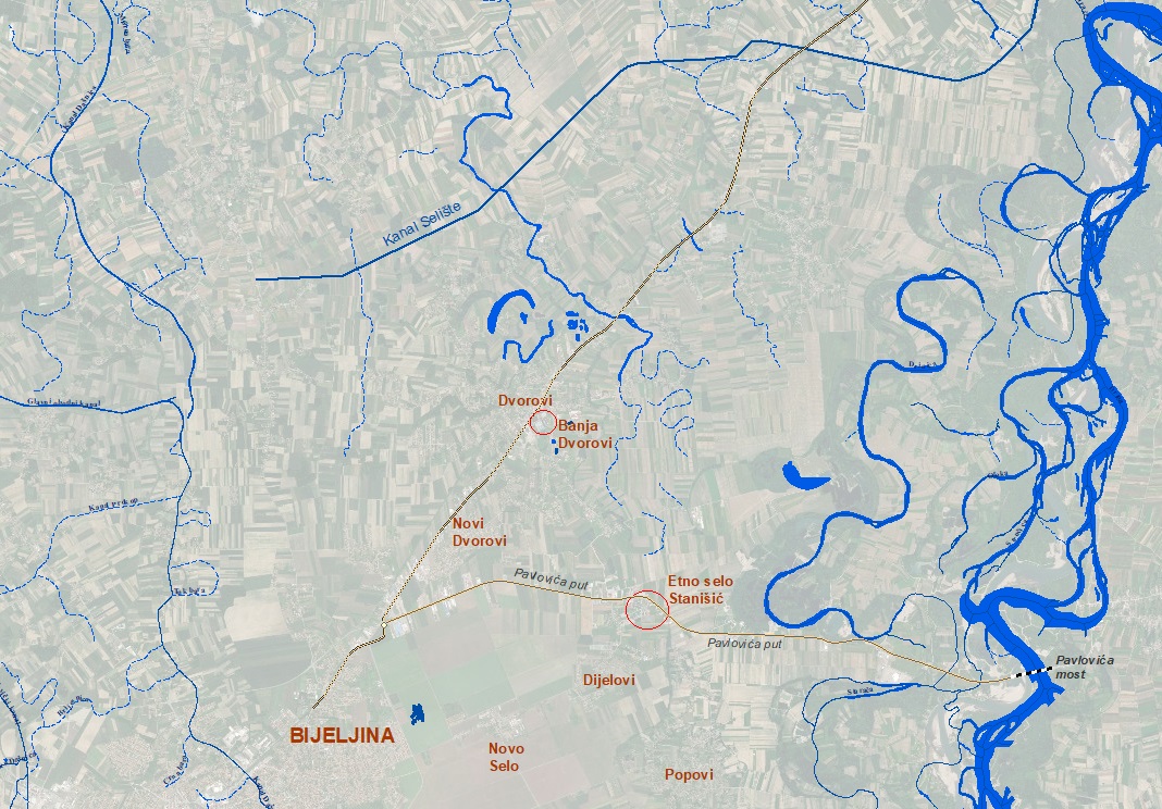
By construction of the access road toward the Pavlovica bridge, the natural interconnection between inundation and natural abandoned watercourses which used to drain Drina water on the left banks was interrupted and thus natural regime of water flow in various hydrological scenarios was disturbed. Figure 1
Based on the establishment of connections of inundation area on the left bank of Drina, following solutions were considered, i.e. technical possibilities:
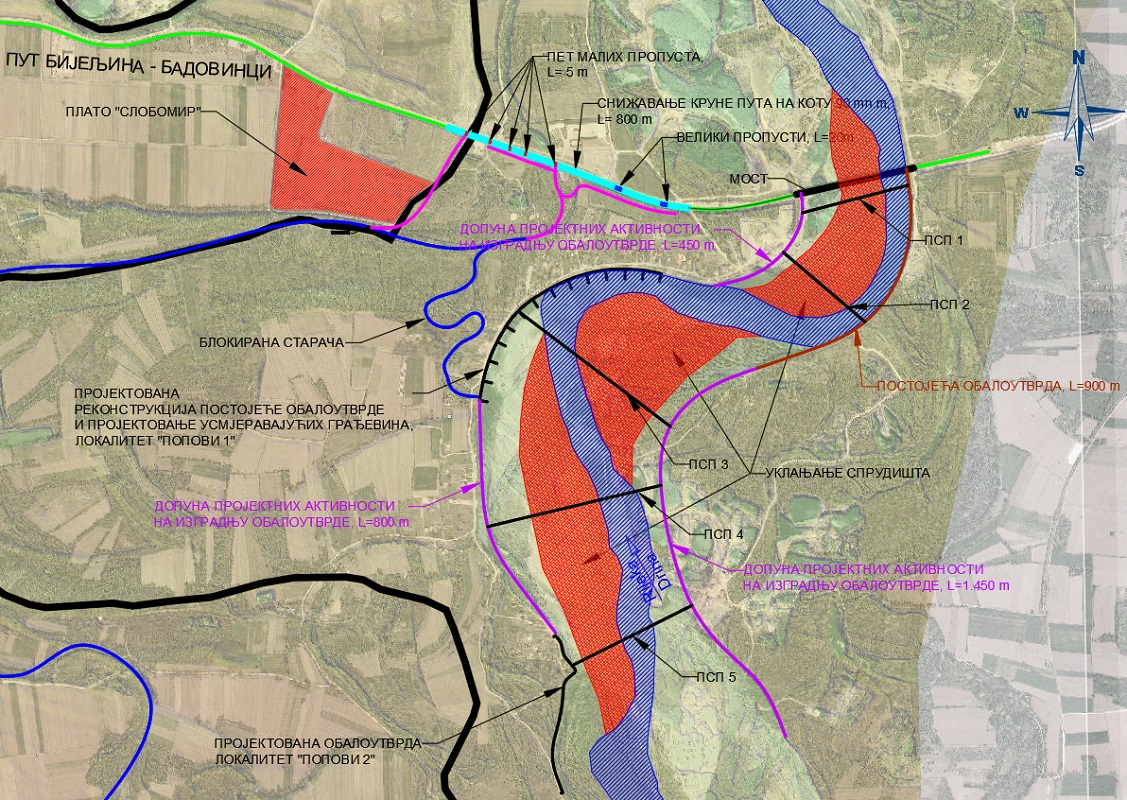
- lowering the road structure at the section from Slobomir to Pavlovica bridge (in order to ensure overflow at lower elevations),
- introducing the outlet under the road,
- regulation of the streambed and dislocation of the river sediment,
In hydraulic analyses the mathematical model of plain flow was used (flow in the horizontal plane) Figure 2.
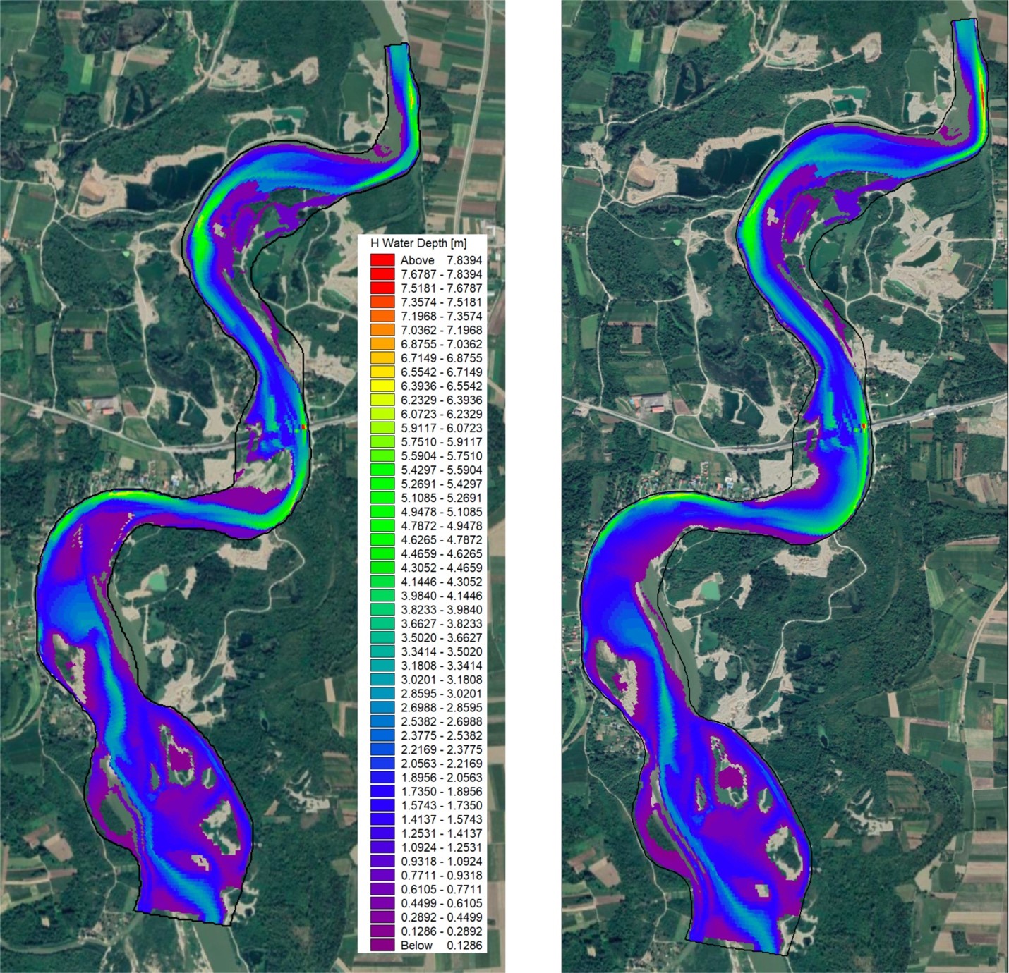
Results of hydraulic analyses indicate positive effects of lowering the road structure and establishment of better interconnections of the wide river valley for lower level but also that significant effects of removing sandbanks on the two curves downstream of bridge. Best results are gained by combining lowering the road structure and removing the sandbank, after that the stabilization of the streambed of Drina should be performed and directing structures constructed, Figure 3.
Planning the outlet in the area of the wide river valley at the left bank is of limited capacity, for several reasons, namely due to reduction of the flood water level but also with flood water being filled with material and increased terrain elevations due to existing objects on the route of former abandoned watercourses. This technical measure would require significant interventions and solving of internal drainage on upstream and downstream sections.
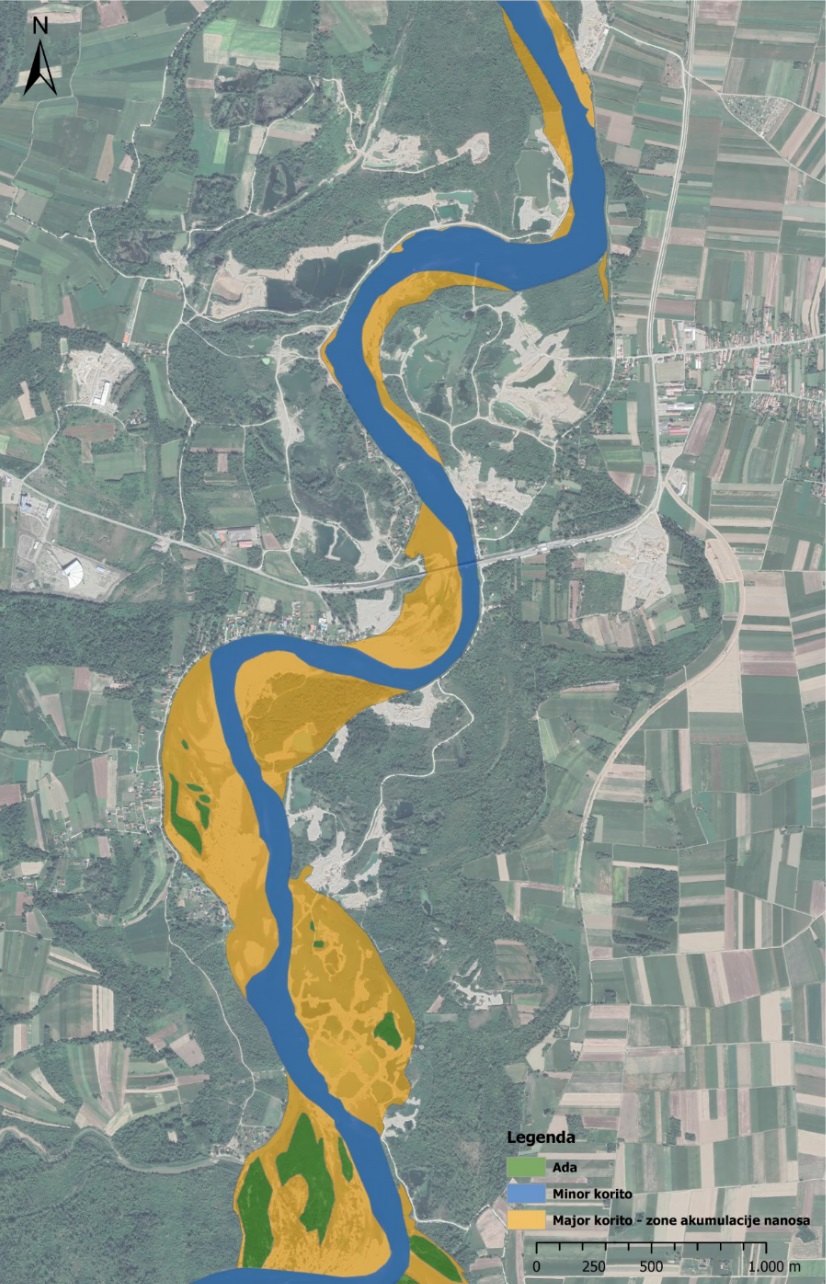
The impact of non-regulated gravel borrow pits is not insignificant which disturbed natural gravitational path of water drainage from the left and right inundation. Figure 4
Possibilities of renaturalization and activation of watercourses from the abandoned watercourses, toward Dvorovi and Dazdarevo settlements after construction of the Drina dykes has been considered.
Having in mind that this is section of Drina water course which is located in the cadaster area of KO Badovinci, Republic of Serbia, and that interventions within the stream bed have to be implemented in cooperation with the water sector of Republic of Serbia, i.e. they have to be generally processed and agreed between Committees of Republic of Serbia and Republic of Srpska, and further implemented based on adopted techcnial solutions and legislation in force.
Implemented morphological and hydraulic analyses is the starting point for consideration of the existing status and impacts of constructed objects under conditions of flood water occurrence and impacts after implementation of possible technical solutions for flood risk mitigation.
Hydrological basis from the Detailed design of the left Drina dyke were used in analyses of basis but within this Study, basis on erosion and sediment are supplemented and morphological analyses of the streambed were performed (existing and designed status).
It is necessary to further develop documentation i.e. to develop Preliminary design of internal and external waters drainage at the flood area of left Drina bank on wider section of settlement along Drina, and further develop Detailed designs according to presented priorities in technical directions, including design of Bistrik watercourse renaturalization.